Capture and document your network — in the field, to the centimeter
Field crews record gas, fibre and water assets with depth and attributes to centimeter accuracy, using the GNSS and locator they already own. Data syncs to the office GIS coordinate-correct — no re-keying, no paper.
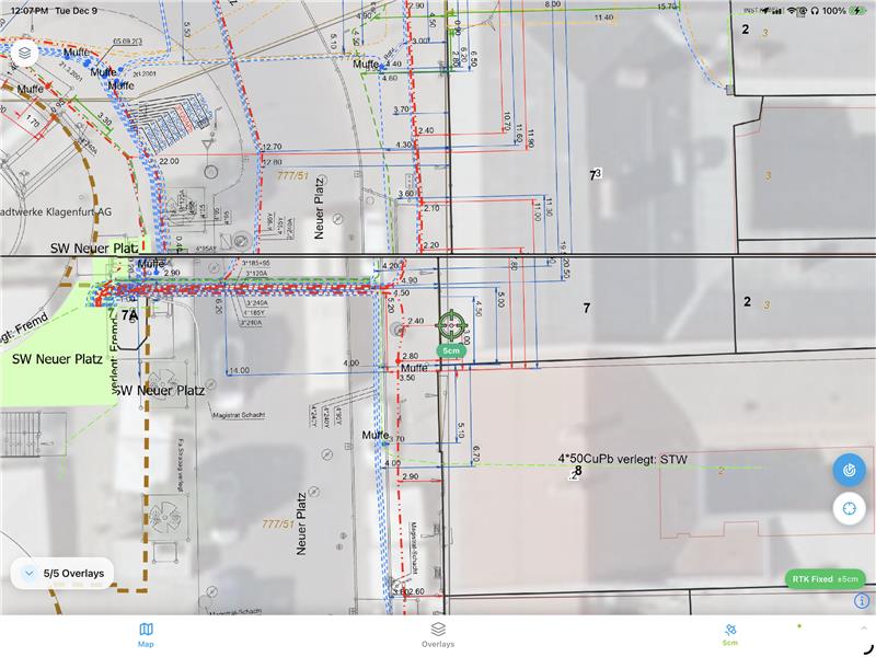
Built for the whole network team
Capture assets where you stand
Record gas, fibre and water assets with depth and attributes to centimeter accuracy, using your GNSS and locator.
Clean data, straight into the GIS
Field captures arrive coordinate-correct with full metadata — no re-keying, no cleanup.
An as-built you can trust
Keep the network record current and accurate as crews build, repair and connect.
Prevent strikes before the dig
A timestamped, geotagged record of buried assets — evidence to protect the network and the crew.
Key Features
Structured asset capture
Points and lines for gas, fibre and water with type, material, diameter and status as attributes.
Works with your locator & GNSS
Pair a Vivax-Metrotech vLoc locator with your GNSS receiver for centimeter-accurate positions.
Depth & metadata on every asset
Record depth of cover, material and condition, with photos attached to each feature.
Fully offline in the field
Capture with no connection; everything auto-syncs when you are back in coverage.
Live sync to the office GIS
Data lands coordinate-correct; export to Shapefile, GeoJSON and DXF for your GIS.
Strike-prevention record
A timestamped, geotagged evidence trail of buried assets for damage prevention.